


Garmin HuntView Plus Maps
Original price was: $89.99.$84.99Current price is: $84.99.
-
Description
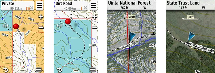
Featuring exclusive BirdsEye Satellite Imagery and 1:24K scale TOPO mapping, these preloaded microSD™ cards offer a seamless hunting map solution for Garmin handheld GPS devices. Map data is collected from multiple sources, providing full state-by-state coverage with routable road and trail data, landowner names and boundaries for public/private land types and boundaries (BLM, National wildlife refuges, National parks, WPA, WMA), food/fuel locations and more. Included BaseCamp™ software lets you interface your computer with your handheld device to plan your hunt, transfer waypoints, and even keep a track log so you can return to the best hunting spots or share the adventure online.
- Easy-to-use mapping solution for hunters and outdoorsmen – plug-in microSD card or download the mapping to a blank microSD card from home
- Identifies landowner names and boundaries for public/private land types and boundaries, using data from multiple sources for superior coverage and detail
- Digital topography equivalent to 1:24,000 scale U.S. Geological Survey maps
- Shows thousands of routable roads and trails with turn-by-turn navigation
- Includes searchable points of interest: parks, summits, geographic place names, camping areas, businesses, and more
- Provides Bureau of Land Management township, range and section information, plus USGS quad location
- Includes hunting management units – containing boundaries and multiple species (where applicable). A device software update is required to view this information and some updates are coming soon. Learn more.
- Compatible with BaseCamp software for managing data on your GPS and computer, trip planning, playing back routes and tracks, geotagging photos and more
- Full state coverage for other states, sold individually.
Additional Information
| Weight | 0.1 lbs |
|---|---|
| Choose State | Alabama, Arizona, Arkansas, California – North, California – South, Colorado, Connecticut, Massachusetts and Rhode Island, Delaware, Maryland, New Jersey and Washington, D.C., East Texas, Florida, Georgia, Idaho, Illinois, Indiana, Iowa, Kansas, Kentucky, Louisiana, Maine, Michigan, Minnesota, Mississippi, Missouri, Montana, Nebraska, Nevada, New Hampshire and Vermont, New Mexico, New York, North Carolina, North Dakota, Ohio, Oklahoma, Oregon, Pennsylvania, South Carolina, South Dakota, Tennessee, Utah, Virginia, Washington, West Texas, West Virginia, Wisconsin, Wyoming |
Reviews (1)
1 review for Garmin HuntView Plus Maps
Only logged in customers who have purchased this product may leave a review.
Related products
-
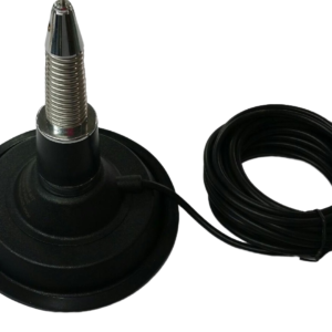
Buzzard’s Roost Long Range Super 6″ Magmount with Spring Whip
Original price was: $60.00.$55.00Current price is: $55.00.-
-
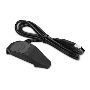
Garmin DC50 Charging Cable/Clip
$24.95-
-
GlowSaver Case for Astro 320/430 with Screen Protectors
Original price was: $18.99.$12.00Current price is: $12.00.-
-
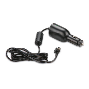
12V Vehicle Power Cable
Original price was: $28.00.$22.00Current price is: $22.00.-

Michael Combs (verified owner) –
When your dog hits that hot trail and crosses the big swamp and swims that big creek then trees 800 to 1000 yds away from drop point you will appreciate these maps. These maps will allow you to find that alternate route to get you around the swamp, creek and obstacles and closer to your treed dog. For an old hunter like me, it allows continued hunting when it would not be possible otherwise. The added property boundaries also help you find and contact landowners for their access permission when needed Thanks Garmin for keeping me going, and Buzzards Roost for knowing what I need and making it available.